Sunnyside Hiking Trail in Aspen Colorado
A 6 mile out-and-back trail, Sunnyside is a moderately difficult hike with wide open views of the valley.


A 6 mile out-and-back trail, Sunnyside is a moderately difficult hike with wide open views of the valley.
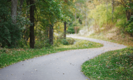
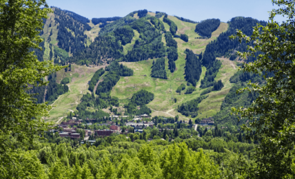
Not too far from downtown Aspen, on Sunnyside Trail, you’ll find yourself on one of the most open and scenic hikes in the Roaring Fork Valley. A 6-mile out-and-back trail that connects Red Mountain to the Hunter Creek Valley, Sunnyside is a moderately difficult trail run best done in the early morning to avoid the heat.
As its name implies, Sunnyside Trail does not have much tree cover and most of the trail is open, dry, and exposed to the sun. The openness of the trail comes with perks as you will have unobstructed mountain and valley views, along with views of Aspen itself.
After an epic day mountain biking the day before, I had a few too many at Zane’s Tavern the night before I did the Sunnyside Hike for the first time. Nevertheless, I rehydrated with some electrolytes and a breakfast sandwich from the Exxon convenience store. Side note: this might sound very gross but a lot of locals get grab-and-go breakfast from the bodega at the Exxon Station on Main Street.
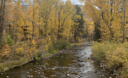
Feeling moderately good, I decided jogging the trial would be the best way to reset. This lasted for a mile or so until the trail got super rocky (see video below). I pushed on through some of the most beautiful wildflower fields and groves of bright aspen trees. I brought a Camelback with me which was a lifesaver. Starting at 9 am, I quickly realized I missed the ideal start time by at least an hour and a half. The sun shines directly on the Sunnyside trail as the mountain is directly west-facing.
Overall, this trail is one of my favorite hikes in Aspen. When you are hiking up, be mindful of mountain bikers coming down. Most MTB riders have bells on their bikes. While I was going up, two young riders came down without bells and caught everyone off guard. The trail is narrow and there are steep drops off the side so it’s sketchy when you have to act fast.
To locate the Sunnyside Trailhead, drive west out of downtown Aspen via Highway 82 for almost a quarter of a mile. Take a right onto Cemetery Lane. Then, cross Slaughterhouse Bridge, and continue onto McLain Flats Road. About .3 miles ( or 1 minute) after you cross Slaughterhouse Bridge, you’ll find the trailhead parking area on the left. Cross the street and the trailhead is right there.
Sunnyside Trailhead
2811 McLain Flats Rd, Aspen, CO 81611
Find more Aspen hiking trails here: