The 5 Best Trails in Aspen, Colorado
Trail running in Aspen offers something for everyone—even beginners.


Trail running in Aspen offers something for everyone—even beginners.
Many know Aspen as a glitzy ski town, and to be sure, the town has gained a certain infamy for its see-and-be-seen apres scene. But locals know the best parts of Aspen aren’t found behind a velvet rope or in a swanky nightclub. Aspen’s prime location in the Roaring Fork Valley means you’re only a few minutes away from world class running, biking, and hiking trails at any given time. Once you’re here, you can choose from trail systems that weave between Ajax Mountain, Maroon Bells, Aspen Highlands, Red Mountain, Snowmass, and Buttermilk. Because of the high property values, these trail systems are very well marked and maintained. Thus, runners, cyclists, and hikers flock to Aspen in the summer months—searching for high altitude single tracks, pristine mountain air, and the best beginner trail runs.
While you do have to give yourself time to adjust to the altitude, you don’t have to be a competitive ultra-runner to run the best trails in Aspen. Aspen boasts scenic running trails for almost every ability and skill level—even beginners. All you need is the right shoes, the right fuel, and this guide to the best beginner trail runs in Aspen.

The Rio Grande Trail is a scenic bike path that runs the length of the Roaring Fork River from downtown Aspen all the way to Glenwood Springs. It’s a great option for runners who are looking for a flat run in Aspen. While the bike path is paved, there is a dirt and gravel shoulder for runners who want to run on a softer surface. There are multiple scenic bridges along this route that are great for stopping to admire the scenery and certain bridges lead to dirt trails along the other side of the river. The Rio Grande trailhead is conveniently located by Clarks Supermarket which offers a large parking lot and makes this route accessible from downtown.
As far as shake out runs go, there’s probably no better place in Aspen than the Rio Grande Trail. By far the most flat terrain you can find in Aspen, the Rio Grande also provides a soft running path along most parts of the Bike Path if you’re looking for a soft surface to recover on. This is a very scenic route—taking you up and down the Rio Grande River. If you’re lucky, you might even spot some deer.
Get the details for this route, here.
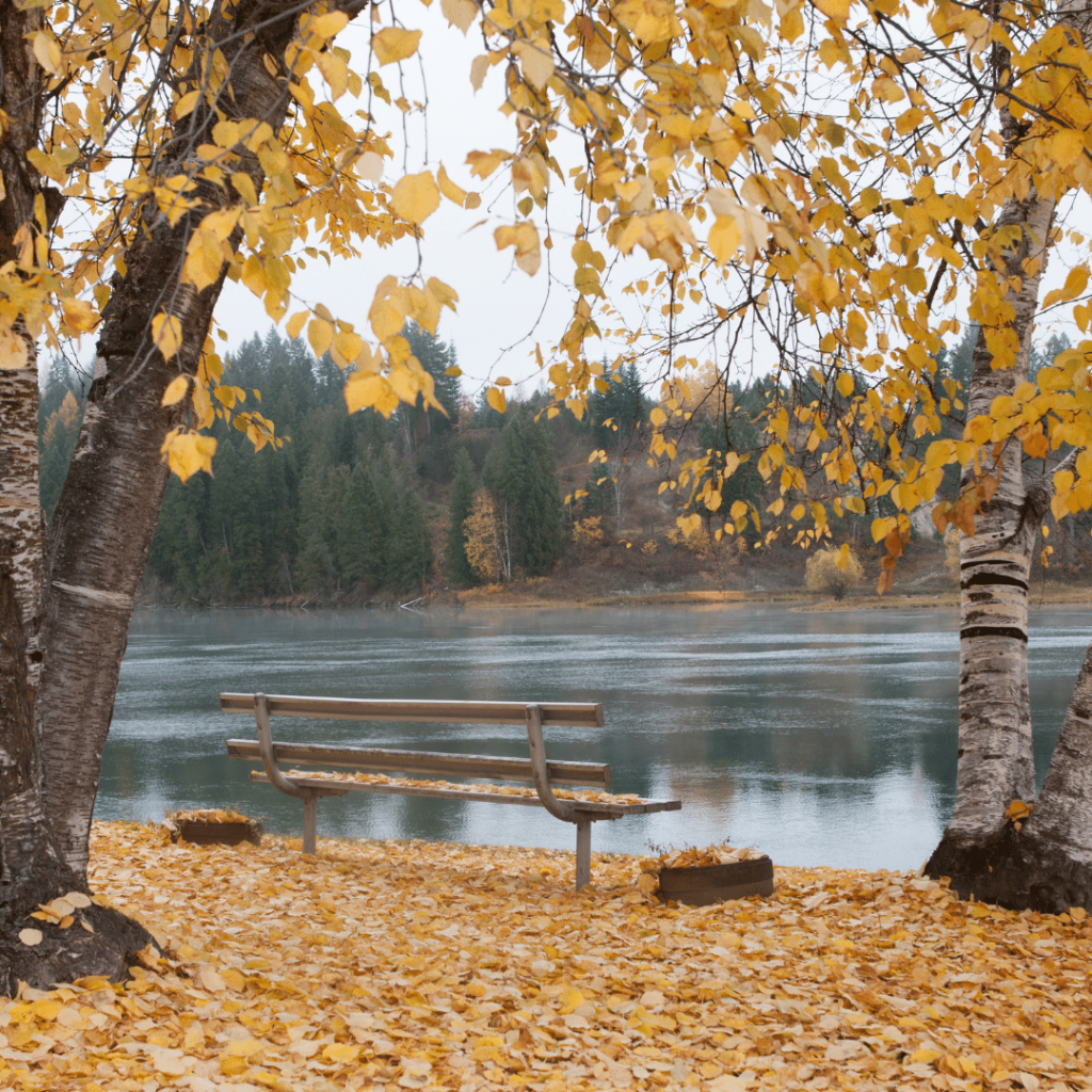
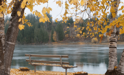
We love this out and back run because it starts and ends at one of the most beautiful (and quiet) parks in the Roaring Fork Valley: Henry Stein Park. Henry Stein Park is a small grassy park surrounded by trees and bordering the Roaring Fork River. It has a dedicated parking lot making it easy to access. Starting at Henry Stein Park, head SE towards downtown Aspen on the adjacent Rio Grande Trail. In 2.4 miles, you’ll reach Herron Park. Turn around here and head back towards Stein Park.
See full route details, here.

The Marolt Trailhead can be found in an unassuming Aspen neighborhood on South 7th Street. Once you see the trailhead sign, follow the bike path past the Holden Marolt Ranching and Mining Museum (stay right) and then veer left before the highway. Continue past the Community Gardens and continue across the bridge towards Maroon Bells. Once you reach Aspen High School, turn around and run back to the start.

With a trailhead tucked in the corner of Koch Park, Ajax Trail is one of the best beginner trail runs in Aspen. This route starts with a short ascent through mountain brush and then traverses across Aspen Mountain (Ajax) before descending back into the other side of town. Head back through downtown Aspen to Koch Park after your descent (via Ute Avenue to E Durant Avenue).
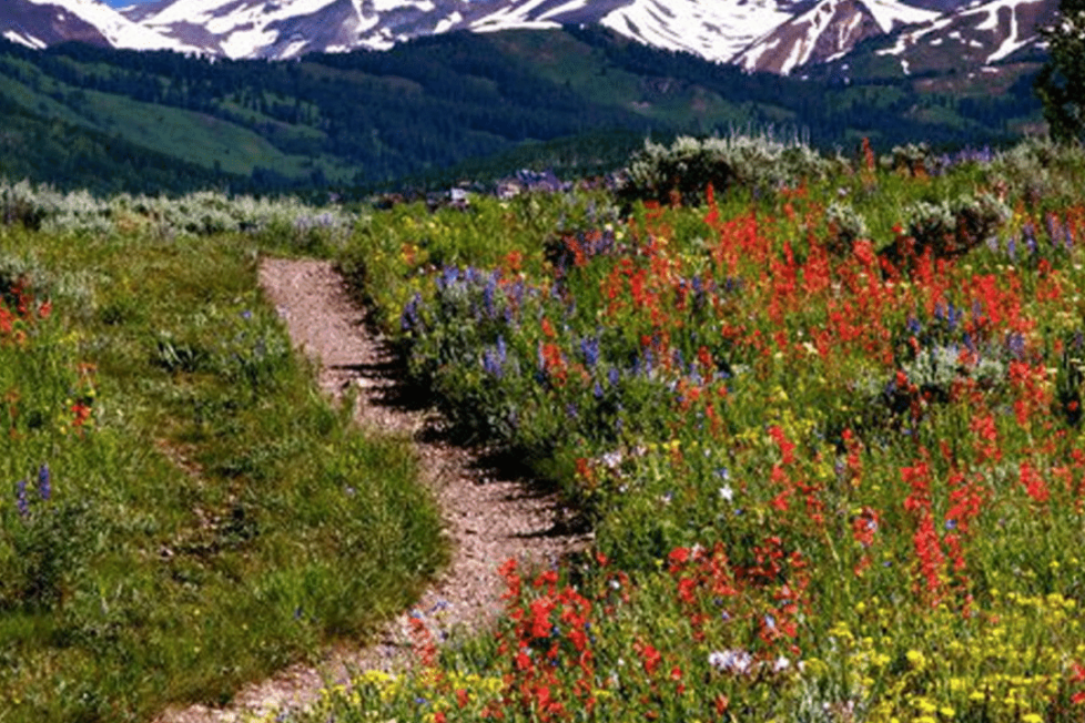
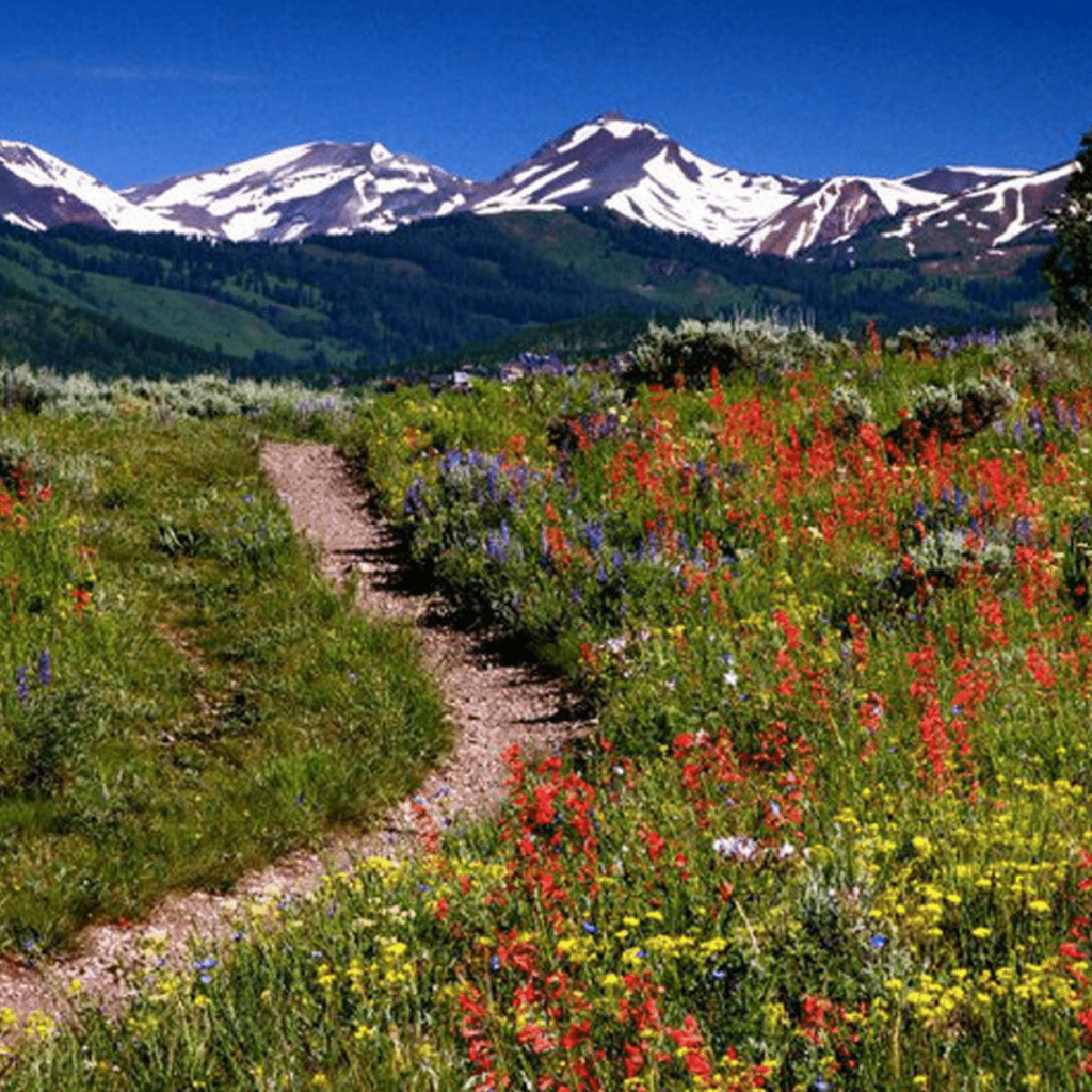
Beautiful wildflowers line the trail and there are spectacular views of downtown Aspen throughout. You can also do this loop in reverse by starting and ending at Ajax Park.
See the full route directions, here.
Local Tip: Koch Park has dedicated parking available or you can find two-hour street parking around the park. This is plenty of time to experience one of the best Aspen hiking trails that is right by the downtown.
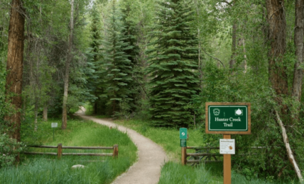
The Lani White Loop is our go-to for Aspen trail running. It starts on the Hunter Creek Trail and connects to the Lani White Trail before heading back towards downtown Aspen. Enjoy the soft dirt trail at the beginning of this run but watch your footing as you ascend the rocky single track and cross multiple wood plank bridges for about a mile.
After ascending a steep wooden staircase, you will see the Lani White Trail sign. Turn right here and begin your descent back into Aspen. Once you reach the Hunter Creek neighborhood, head down Spruce Street (keeping right). Then turn right on South Ave/Gibson Ave until you see the Oklahoma Flats Trail Sign on your left. Turn left onto the Oklahoma Flats Trail and then right once it meets the Rio Grande Trail. Stay on the Rio Grande Trail (heading towards Clark’s Market) until you’re back at the starting point.
Local Tip: Go early in the morning to avoid having to pass numerous hikers, as this is a popular Aspen hiking trail conveniently accessed from downtown Aspen. There are multiple scenic points, bridges, and spectacular views of Aspen Mountain on your descent.
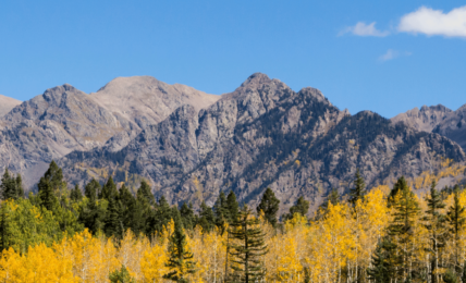
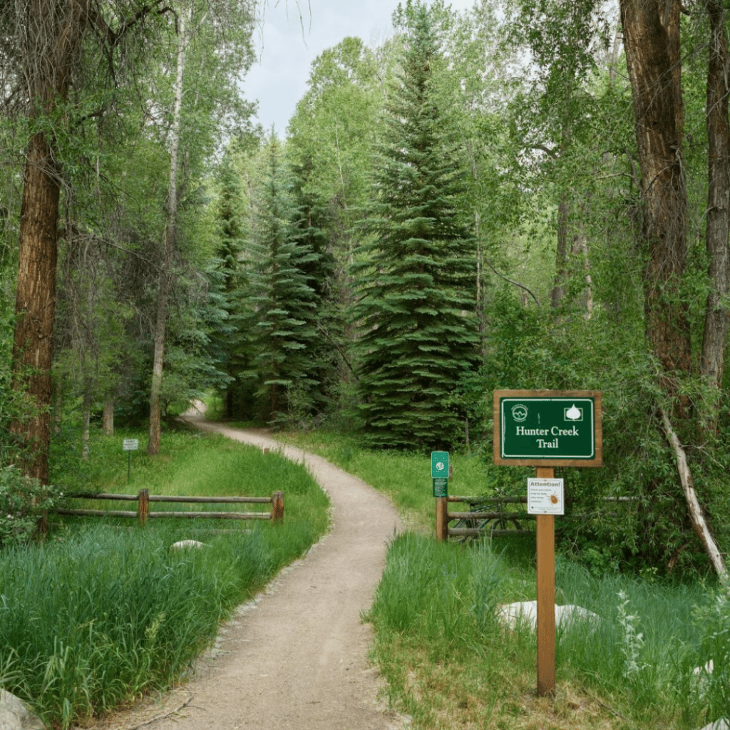
This route starts at the Hunter Creek Trailhead off the Rio Grande Trail (by Clarks Market) and combines the upper and lower Hunter Creek Trails. This wooded run is around ~14 miles (out and back). The lower part of the trail follows Hunter Creek through picturesque aspen and conifer forest, while the upper part climbs into high meadows with views of the Elk Mountains and the Sawatch Mountains to the west and east. The single-track trails are primarily soft underfoot and take you across bridges, over rivers, and through scenic Aspen hiking trail backcountry.
See the full route details, here.
Not too far from downtown Aspen, on Sunnyside Trail, you’ll find yourself on one of the most open and scenic hikes in the Roaring Fork Valley. A 6-mile out-and-back trail that connects Red Mountain to the Hunter Creek Valley, Sunnyside is a moderately difficult trail run and hiking trail in the summer. It is best done in the early morning to avoid the heat. As its name implies, Sunnyside Trail does not have much tree cover, and most of the trail is open, dry, and exposed to the sun. However, the openness of the path comes with perks, as you will have unobstructed mountain and valley views, along with views of Aspen itself.
To locate the trailhead, drive west out of downtown Aspen via Highway 82 for almost a quarter of a mile, take a right onto Cemetery Lane, cross the bridge, and then take a left onto McLain Flats Road. Here you’ll find a parking area on the left. This is also one of the best Aspen Hiking Trails.
See full route details, here.
The best shoe for trail running in Aspen depends on the type of terrain you will be encountering. These are our recommendations for the best trail running shoes in Aspen according to terrain:
If there is something runners love more than running, it’s refueling afterward. High altitude runs can be taxing, so it’s essential to refuel with hearty, whole foods. Whether you’re looking for a refreshing smoothie, an organic panini, or a delicious vegan meal, check out our complete guide to the best healthy food in Aspen. Here are the highlights:
Trail running in Aspen can be hot, cold, and warm all at once. It’s essential to check the daily conditions to make sure you’re wearing the right gear. Sunscreen and sunglasses are always a good idea at such a high altitude. In addition to the basics, these are some must-have items for trail running in Aspen: